

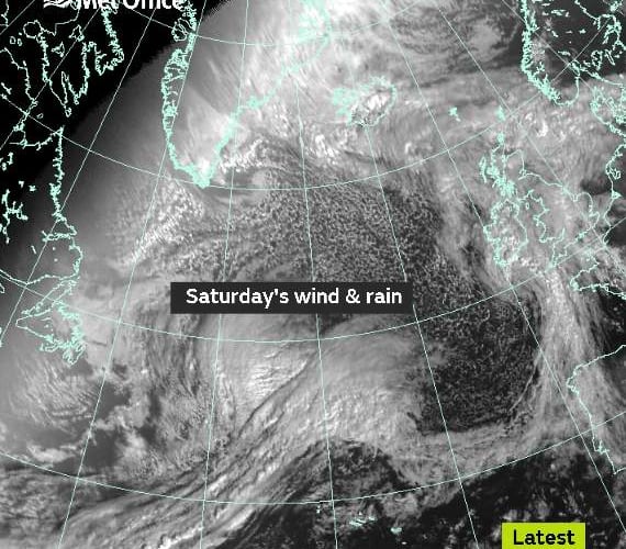
Thursday has already been wet and windy and worse weather is in store this weekend.
A Yellow Wind Warning has been issued for strong southwesterly winds and heavy rain on Saturday, from 4am, covering parts of southern England and South and West Wales.
Chief Forecaster for the Met Office, Frank Saunders said: “A very deep area of low pressure is expected to bring strong winds to southern areas early on Saturday morning. During the morning and early afternoon these winds will transfer east and slowly change direction as they will become westerly and eventually northwesterly toward the end of the warning period.
“Gusts exceeding 50 mph are expected widely within the warning area, with gusts of around 70 mph along exposed coastal areas. These are expected to coincide with high tides, leading to locally dangerous conditions.”




Dave Throup of the Environment Agency tweeted to let residents know that ahead of the weekend’s storm the EA is ‘checking out our flood structures across the West Midland.’
The weather system hasn’t been officially named yet although many are calling it ’Storm Brian’.
As the system is expected to bring strong gusts during Saturday, there is the obvious potential of risk to travellers. RAC spokesman Pete Williams said: “Drivers encountering high winds are advised to reduce their speed, ensure they hold the steering wheel firmly and be prepared for sudden gusts, debris and even fallen branches in the road. Allow plenty of room between your vehicle and the next and take extra care when overtaking cyclists, motorcyclists and lorries as they are susceptible to being blown around easily by side winds. Be extra cautious when driving on exposed roads, high ground and across bridges where again sudden gusts can blow you off course. “
Comments
This article has no comments yet. Be the first to leave a comment.